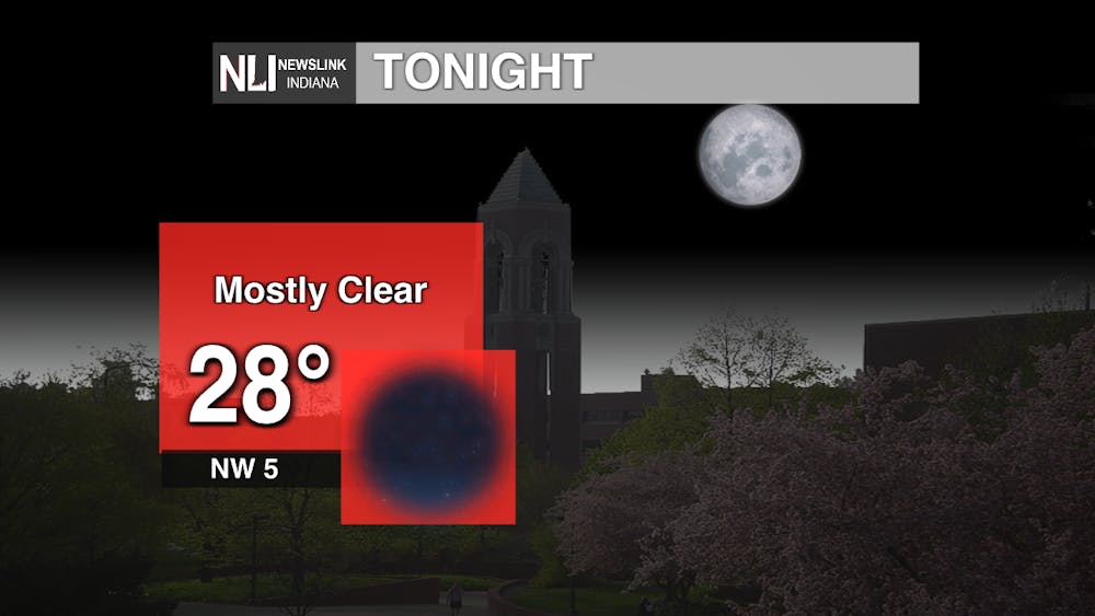
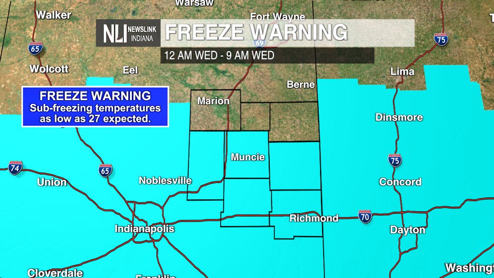
Tonight: A very calm and quiet night under mostly clear skies is ahead. Calm winds will allow widespread frost throughout the region once again. With light winds and overnight temperatures below freezing, a Freeze Warning remains in effect from midnight to 9:00 a.m. Wednesday. Make sure to bring any sensitive plants and animals indoors this evening and bundle up if you go outside.
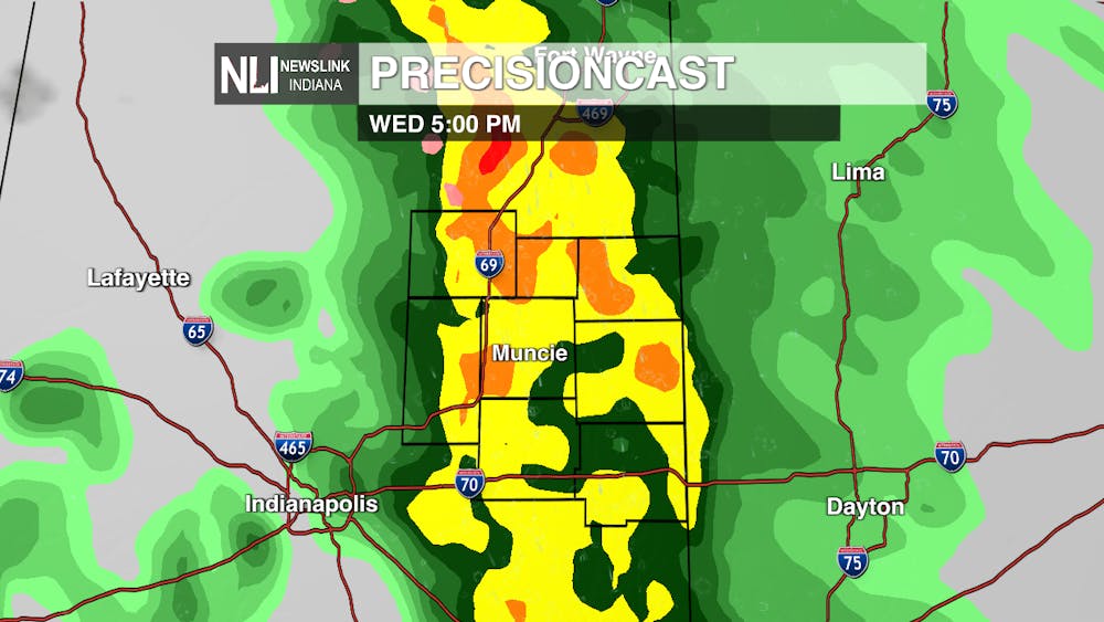
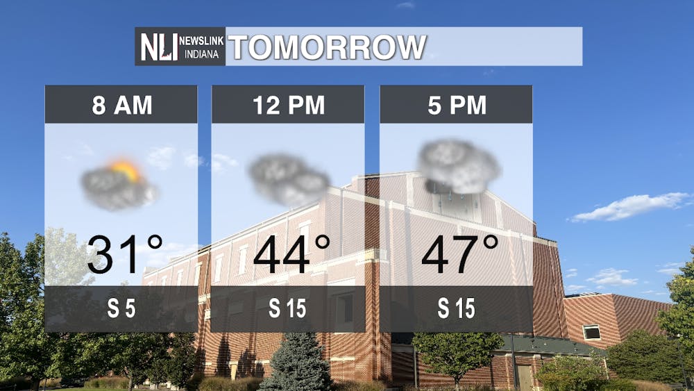
Tomorrow: Winds will begin to shift out of the south throughout the day, bringing high temperatures up into the upper-40s. A warm front will lift out of the southwest by mid-afternoon, bringing widespread showers into the region through the late afternoon and early evening.
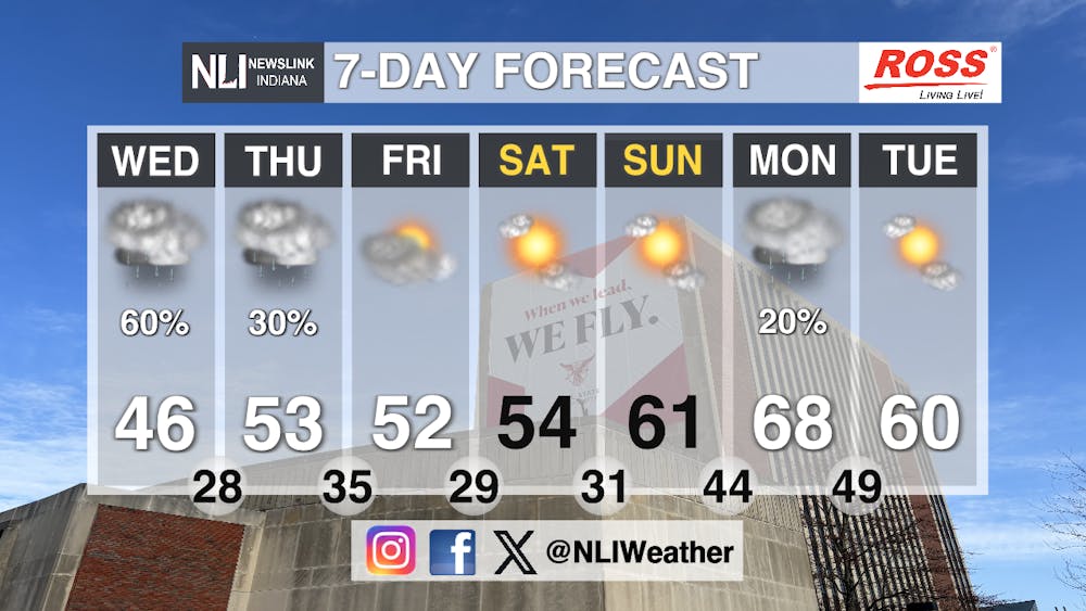
Seven-Day Forecast: As southerly winds continue, a gradual warm-up will continue through the end of the week, with temperatures into the mid-50s by the end of the week. Warmer weather and sunny skies continue through the weekend, before rain chances return early next week with temperatures near to above normal.
- Chief Weather Forecaster Noah Gordon
Follow us on Twitter @NLIWeather for breaking weather updates.
NewsLink Indiana is a proud Ambassador for the NOAA Weather-Ready Nation program.
For more information about the Weather-Ready Nation program please click HERE