
Tonight: Severe thunderstorms are going to make their way through Muncie early in the evening. Heavy rain, winds, hail, and an isolated tornado are all possible with this storm system. Make sure you stay weather aware throughout the night and receive all weather updates. Lows will dip into the 30s with winds picking up to 15 mph and gusts up to 40 mph.

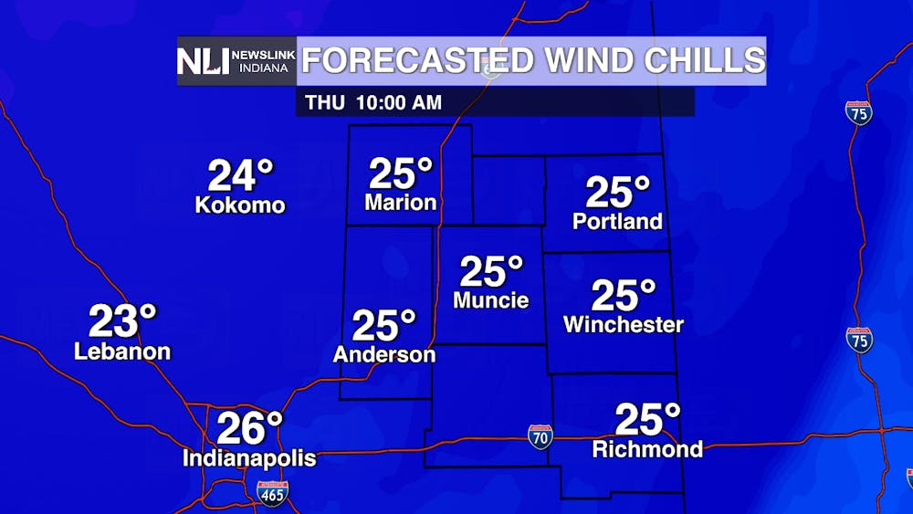
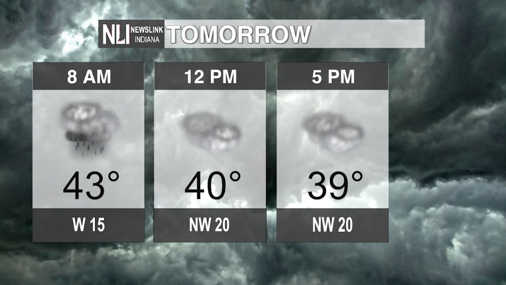
Tomorrow: A drastic cooldown will take full swing in the morning hours with wind chills dipping into the 20s by 10:00 a.m. Watch out for rain and even snow in the morning as you head to work as visibility may be limited. Winds will be blowing at 15-20 mph during the day, adding to the wind chill effect. The skies will remain cloudy after precipitation makes its way out by noon, making for one more winterlike day.
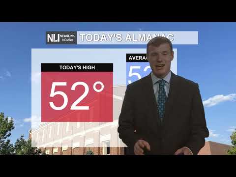
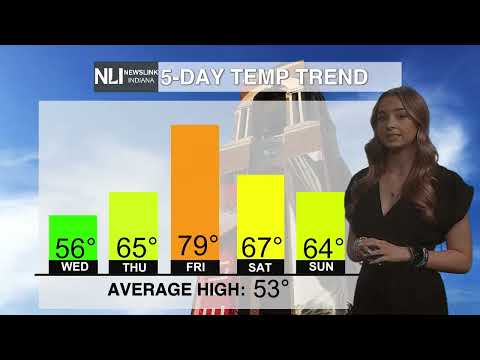
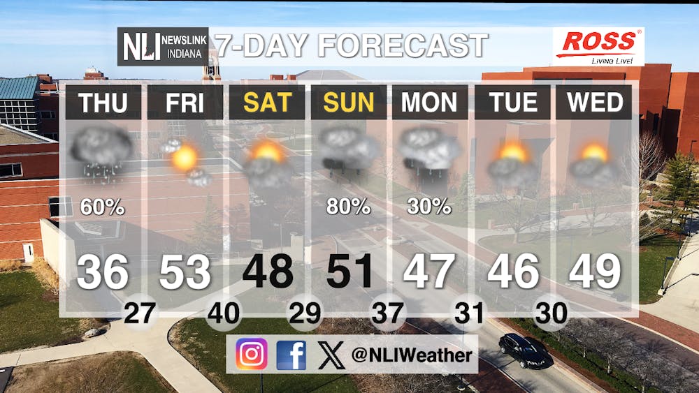
Seven-Day Forecast: The sun will return on Friday as temperatures warm back up the the low-50s. Highs will remain consistent during the week and be in the average range for mid-March. Rain chances return on Sunday and linger into Monday before clearing up again by mid-week. Lows are going to dip below freezing on multiple occasions throughout the week, meaning we may see frost again this March. Make sure you stay tuned to NewsLink Indiana for all weather updates.
- Assistant Chief Weather Forecaster Joseph Sawicki
Follow us on Twitter @NLIWeather for breaking weather updates.
NewsLink Indiana is a proud Ambassador for the NOAA Weather-Ready Nation program.
For more information about the Weather-Ready Nation program please click HERE


