
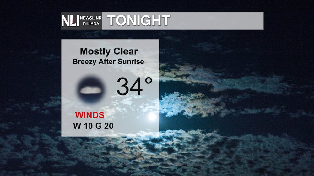
Tonight: Aside from the visit from a few mid and low-level clouds, tonight should be a decently clear night. This and the dry air we have present work together to lower that nighttime/early-morning temperature to a chilly 34°. Winds relax overnight, but should keep the air mixed enough to keep frost out of the forecast for the most part.
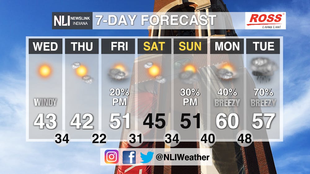
Tomorrow: Abundant sunshine as those low and mid-level clouds lighten up, but cooler air on some renewed strong NW breezes will make things feel more like late February or even earlier. The high will be 42°, but feels-like temps will be in the mid-30s! Where's Spring on its first full day?

7-Day Forecast: Take a gander at the turn in our weather from the weekend onward! We have more 40s Thursday, but we work our way towards 60° by the time we hit the beginning of next week. Beyond that, after some thankfully calm weather, another hallmark of the Spring season returns with the chance for showers-and possible thunderstorms-by mid week. We will have to keep our eyes on next week because the weather pattern favors some stronger storms by the 26th.
--Weather Forecaster Ryan Hill
Follow us on Twitter @NLIWeather for breaking weather updates.
NewsLink Indiana is a proud Ambassador for the NOAA Weather-Ready Nation program.
For more information about the Weather-Ready Nation program please click HERE