

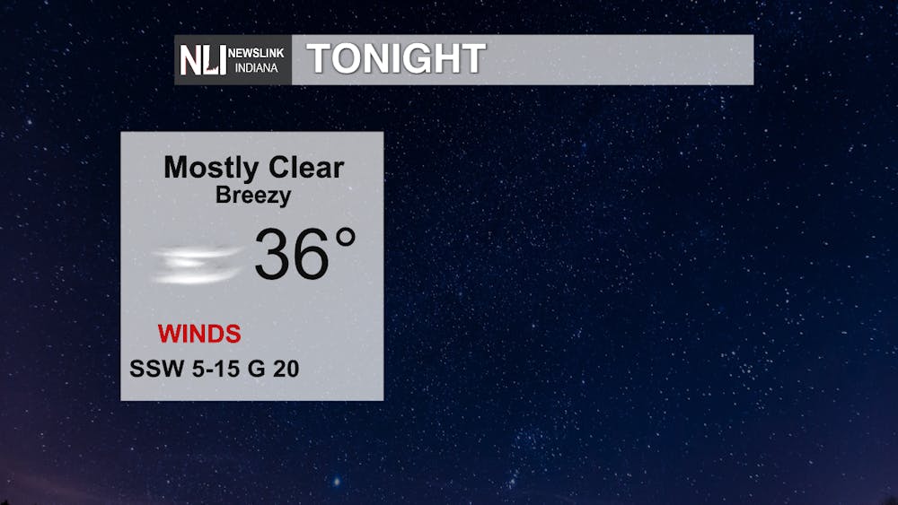
Tonight: A rather chilly night is ahead, but not as chilly as nights prior. A low in the mid 30s, with mostly clear skies. It will be breezy with sustained winds of 5-15 mph, with some gusts up to 20 mph.
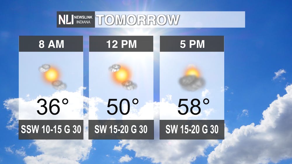
Tomorrow: The warming trend continues. The day start off sunny, with cloud cover moving in for the afternoon, but rain chances are non-existent for the afternoon and evening. A high of 58, with more windy conditions. Expect sustained winds of 10-20 mph with gusts up to 30 mph.
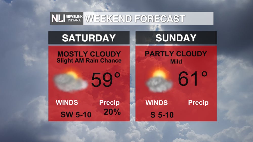
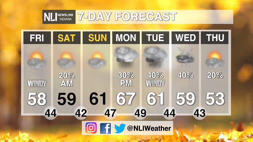
Weekend: There is a slight chance for a scattered shower Saturday morning, but most will be dry and those chances vacate the premises by sunrise. Otherwise, a mix of clouds throughout the weekend, with upper 50s Saturday, and we return to the 60s on Sunday!
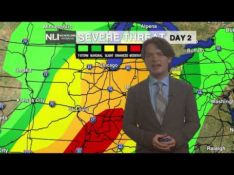
7-Day: 60s continue into next week, with Monday looking to be our warmest day on the 7-Day. Rain chances do return Monday, and continuing through the week as a weather system passes through.
-Weather Forecaster Lance Huffman
Follow us on Twitter @NLIWeather for breaking weather updates.
NewsLink Indiana is a proud Ambassador for the NOAA Weather-Ready Nation program.
For more information about the Weather-Ready Nation program please click HERE


