Tonight: A relatively quiet and cool night is ahead, with low temperatures in the upper 30s under mostly cloudy skies.

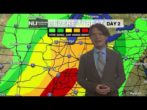
Tomorrow: A very active and potentially significant weather event is ahead tomorrow, with all modes of severe weather possible. We will start out the day quite warm in the upper 40s, with winds surging out of the southwest at up to 30 mph. A morning line of storms will move through the region between 8-11a.m., before clearing out by midday. Following this line, a potentially damaging squall line will develop and move through the region into the early evening hours into the overnight period. Damaging winds, large hail, and even a few tornadoes are possible. The more sunshine we see in the afternoon, the more energy storms will have to work with later into the evening. Remain weather aware throughout the day!


Seven-Day Forecast: After the severe weather threat moves through, steady rainfall and shower chances will continue through the weekend. This may lead to flooding, especially in low-lying areas and river watersheds. As a result, a Flood Watch is in effect for the southern half of the viewing area from Wednesday afternoon until Sunday morning. Temperatures will cool off to near average by the weekend, before below average temperatures and sunshine returns early next week.

- Chief Weather Forecaster Noah Gordon
Follow us on Twitter @NLIWeather for breaking weather updates.
NewsLink Indiana is a proud Ambassador for the NOAA Weather-Ready Nation program.
For more information about the Weather-Ready Nation program please click HERE


