

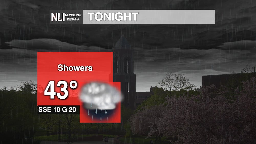
Tonight: A brief period of overcast will give way to rain showers after midnight. Heavier pockets of rain are expected with tonight's showers. Lows will dip into the low-to-mid-40s with temperatures remaining consistent throughout the evening. Winds will come from the south southeast at 10 mph and gusts picking up to 20-25 mph.
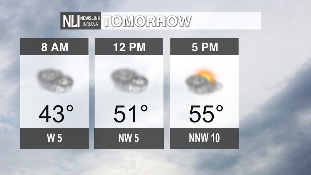
Tomorrow: Cloudy skies will linger throughout the day before sunshine peaks through by the late afternoon. Temperatures will increase into the mid-50s, getting closer to average April temperatures, with winds coming from the northwest at 5-10 mph.
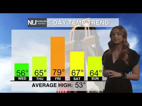
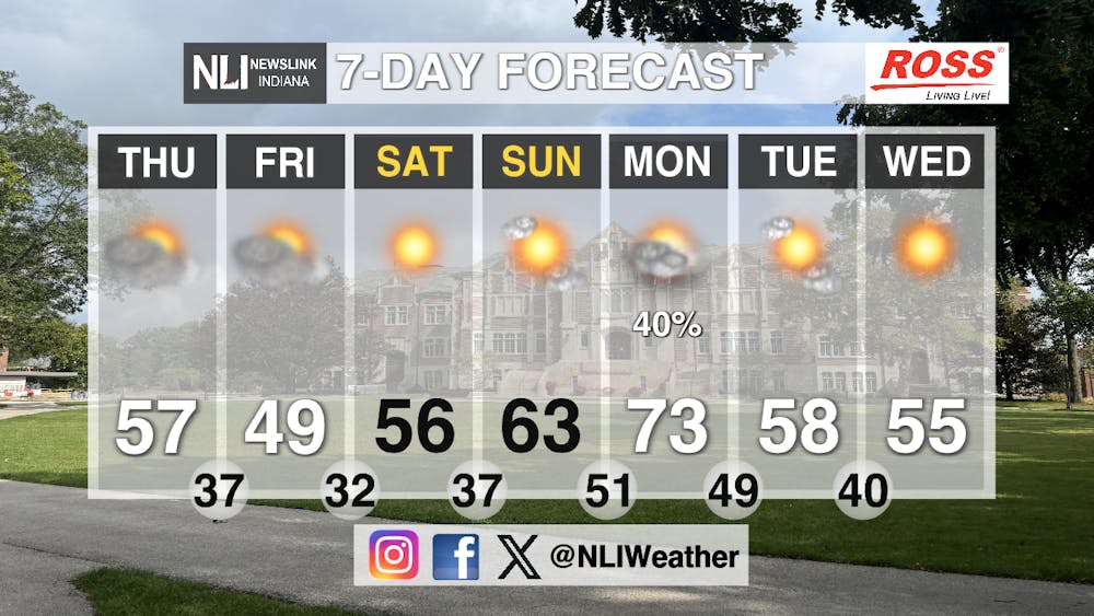
Seven-Day Forecast: Sunshine returns just in time for the weekend with the cloud cover exiting our area by Friday evening. Temperatures are going to warm up into the 60s before peaking at 73 degrees on Monday. Rain chances return at the start of next week before temperatures fall back into the 50s by mid-week. Lows will dip into the 30s, even reaching the freezing point Friday evening, before warming up as well into the low-50s. With a break from rain expected, make sure you get outside and enjoy the spring conditions this weekend!
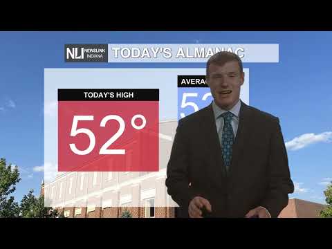
- Assistant Chief Weather Forecaster Joseph Sawicki
Follow us on Twitter @NLIWeather for breaking weather updates.
NewsLink Indiana is a proud Ambassador for the NOAA Weather-Ready Nation program.
For more information about the Weather-Ready Nation program please click HERE


