Tonight: A quiet and cold night is ahead, with low temperatures in the upper 20s with an ENE wind at around 10mph.

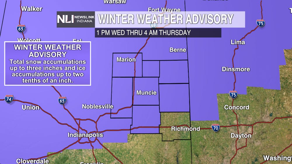
Tomorrow: Our stretch of active weather begins, as a low pressure system bringing snow, freezing rain, and ice concerns moves into the region late tomorrow, with icing impacts and a few inches of snow possible through early Thursday. A Winter Weather Advisory is in effect for nearly all of East Central Indiana from 1pm Wednesday through 4am Thursday.

7-Day Forecast: A quiet 36 hours persists after Thursday, with a sunny and calm day for Valentine's Day, with temperatures right around the freezing mark. Our next storm system approaches Saturday, with another chance at snow, freezing rain, and ice possible throughout the first half of the weekend, with snow showers lingering into Sunday. Temperatures quickly drop as we head into next week, before recovering into the middle 30s by the middle of next work week.

- Chief Weather Forecaster Noah Gordon
Follow us on Twitter @NLIWeather for breaking weather updates. NewsLink Indiana is a proud Ambassador for the NOAA Weather-Ready Nation program. For more information about the Weather-Ready Nation program please click HERE


