


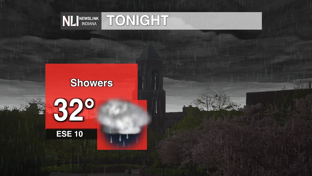
Tonight: Mixed precipitation that is part of a larger system will impact Muncie this evening. Freezing rain can create slick conditions and lead to hazardous travel. This precipitation will change over to rain around midnight. Temperatures will remain around freezing and winds will be blowing at 10 miles per hour.
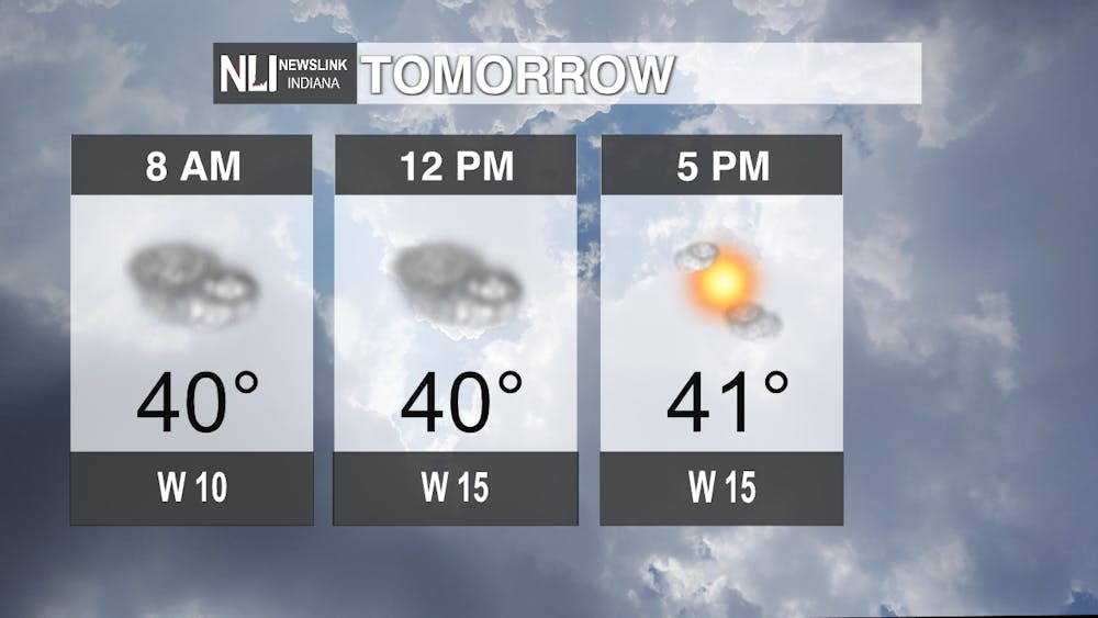
Tomorrow: Temperatures will remain consistent in the low-40s for the entire day. Heavy cloud cover will make its way out in the afternoon, leading to mostly sunny skies. Winds will be a bit breezy, blowing from 10-15 miles per hour throughout the day.
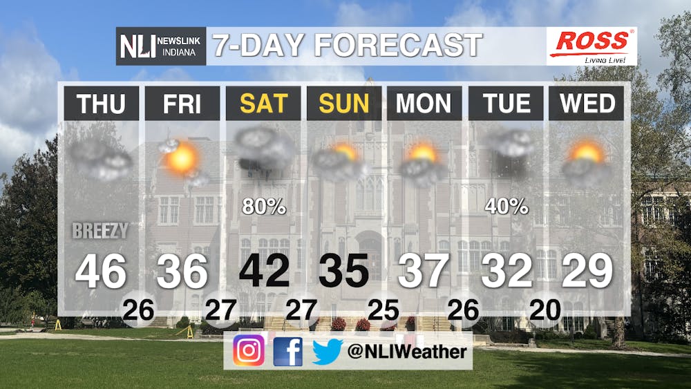
Seven-Day Forecast: Muncie will experience some weather whiplash with regard to temperatures in the week ahead. Highs will range anywhere from the low-30s to the mid-40s. However, lows will consistently stay in the mid-20s for the duration of the week. Another precipitation system will enter the region on Saturday before exiting in the evening hours. This will leave us with mostly cloudy skies for the remainder of the week with a chance of flurries possible Tuesday.
Assistant Chief Weather Forecaster Joseph Sawicki
Follow us on Twitter @NLIWeather for breaking weather updates.
NewsLink Indiana is a proud Ambassador for the NOAA Weather-Ready Nation program.
For more information about the Weather-Ready Nation program please click HERE


