


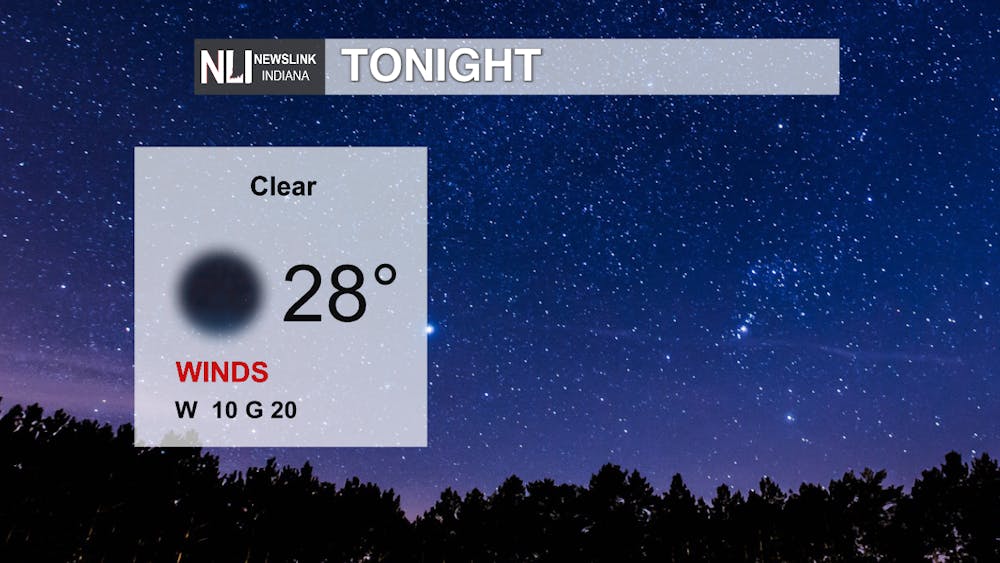
Tonight: A lot calmer tonight compared to what we saw yesterday evening. A bit cooler than what we'd like to see, but not unusual for early February. Clear skies with winds picking up as we continue on later into the night.
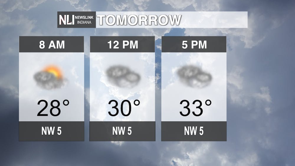
Tomorrow: Temperatures will continue to increase as we continue on through the day. By evening we will barely make it above freezing for the high. Not only will temperatures increase throughout the day, but overcast accumulation will continue to increase throughout the day as well. Wind speeds will continue to decrease tomorrow, getting a lot more calmer as we approach the evening.
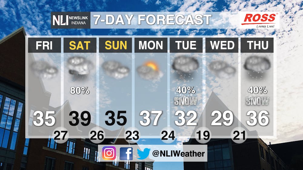
7-Day Forecast: The temperature pattern for Muncie over the next seven days will look very similar ranging from the mid to high 30's heading into the weekend and next week. The low temperatures will start to decrease, simultaneously slowly getting colder until we hit Wednesday where those lows will start to increase again. Fun fact: temperatures were 10 degrees warmer last year for both highs and lows than what they are this year. On Saturday, there's a high percentage of precipitation possibly accumulating into ice as we move later into the evening. Tuesday, Wednesday and Thursday have a small chance to bring about snowfall. Temperatures this week are still speaking winter, so continue to bundle up when you go out!
Weather Forecaster Rachel Fulton
Follow us on Twitter @NLIWeather for breaking weather updates.
NewsLink Indiana is a proud Ambassador for the NOAA Weather-Ready Nation program.
For more information about the Weather-Ready Nation program please click HERE


