Tonight: Another chilly night will bring snow showers into our area with accumulations around an inch. Lows will again dip into the single-digits with winds blowing at 10 mph and gusting up to 20 mph.

Tomorrow: Snow will move out of the area leaving behind overcast skies for most of the day with the sun peaking through in the late afternoon. Winds will be blistery at 10-15 mph throughout the day. Tomorrow will be the last extreme cold day in the near future with a high of 19 degrees. Wind chills will be in the negatives for your morning commute, so bundle up and stay warm as you head out the door.

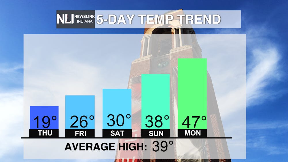
Seven-Day Forecast: Temperature relief is on the way as warmer highs look to break the stretch of cold conditions. Below average temperatures will become above average within a five-day span. Evening lows are also on the way up, reaching the freezing point and above it next work week. The sun will make a lengthy appearance with mostly sunny skies in the forecast for the weekend. The end is in sight for these cold temperatures and wind chills, so make the most of this temperature increase when it happens.

-- Assistant Chief Weather Forecaster Joseph Sawicki
Follow us on Twitter @NLIWeather for breaking weather updates.
NewsLink Indiana is a proud Ambassador for the NOAA Weather-Ready Nation program.
For more information about the Weather-Ready Nation program please click HERE .