


Tonight- This evening will feature snow flurries periodically throughout the evening. There will be a 30% chance of snow, with 24 F temperatures with 18 mph gusts.

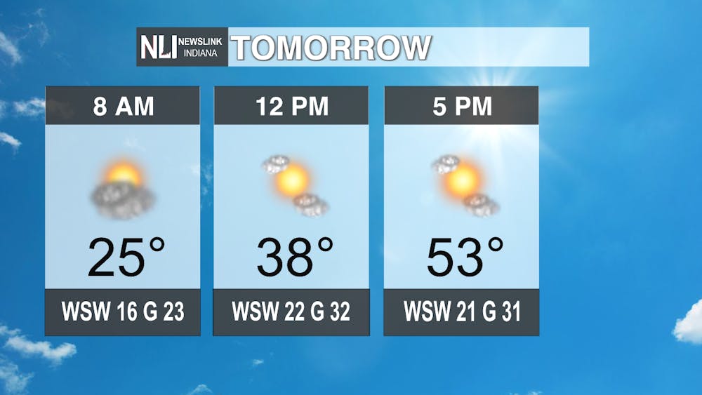
Tomorrow- It will be 54 F, but will stay cool with gusts up to 32 mph gusts. Those gusts will stick around throughout the day, so keep a jacket on you all day long.
7-Day Forecast- The winds on Tuesday will be replaced by temperatures in the low 40s on Wednesday and Thursday. Friday will see a 30% chance of showers, which could transition to snow if the overnight temperatures go below freezing. Keep an eye on the forecast as we head towards the weekend. Saturday will be a cool 45 F, but Saturday will be a warmer 52 F. The weekend will also see rain move in Sunday evening into Monday morning to start the week.

-- Weather Forecaster Ian Kowalski
Follow us on Twitter @NLIWeather for breaking weather updates.
NewsLink Indiana is a proud ambassador for the NOAA Weather-Ready Nation program.
For more information about the Weather-Ready Nation program, please click HERE.


