
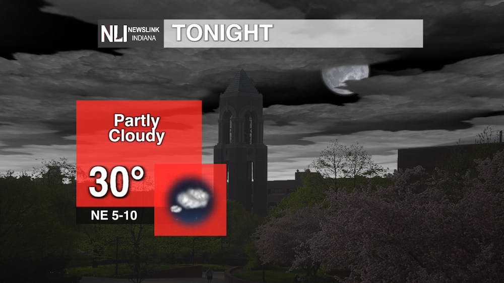
Tonight:
Partly cloudy skies return overnight as low temperatures remain near freezing. With light winds, some patchy fog can be expected especially in our northern counties.
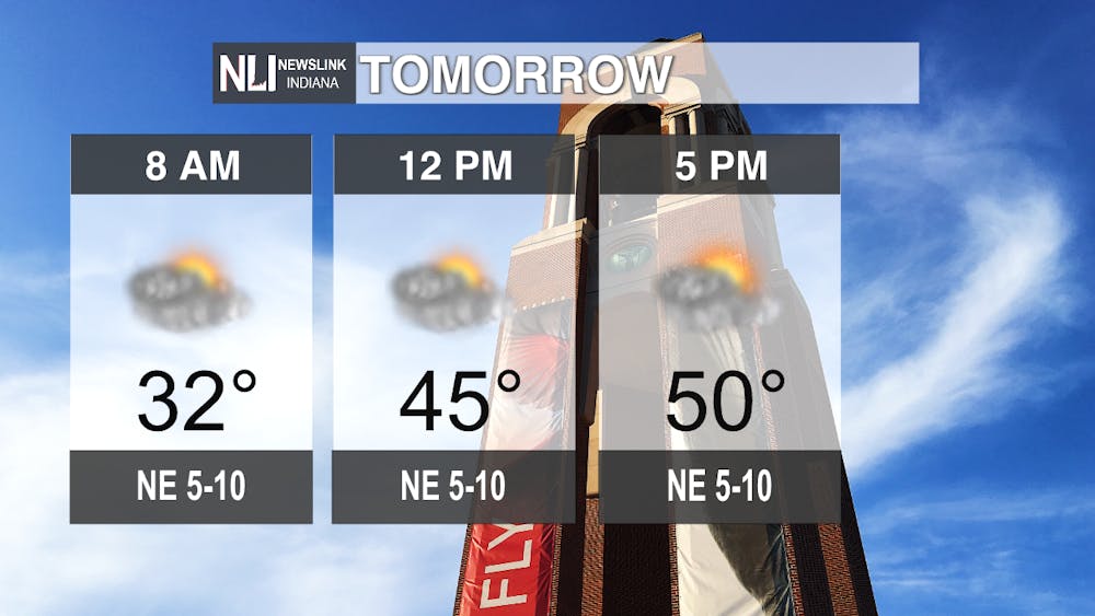
Tomorrow:
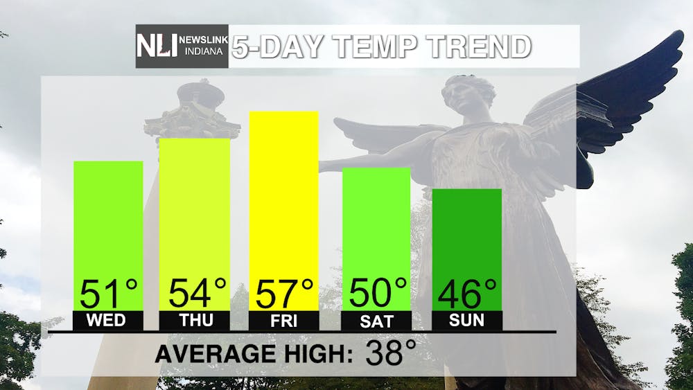
An even warmer day is ahead, as cloud cover remains but southerly winds push warmer air into the region. Highs across the region should even climb into the low 50s, more than ten degrees above average for this time of year.
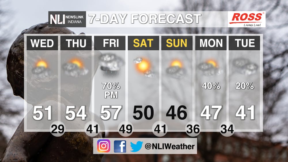
7-Day Forecast:
High temperatures look to continue to climb above 50 degrees into Friday, where we may see record-breaking warm temperatures. However, our spring-like feel ends late Friday, as a cold front moves through the region, bringing us back to around normal temperatures for the weekend. As we head into early next week, clouds return with the added chance of rain.
-- Assistant Chief Weather Forecaster Noah Gordon
Follow us on Twitter @NLIWeather for breaking weather updates.
NewsLink Indiana is a proud Ambassador for the NOAA Weather-Ready Nation program. For more information about the Weather-Ready Nation program please click HERE
Read More
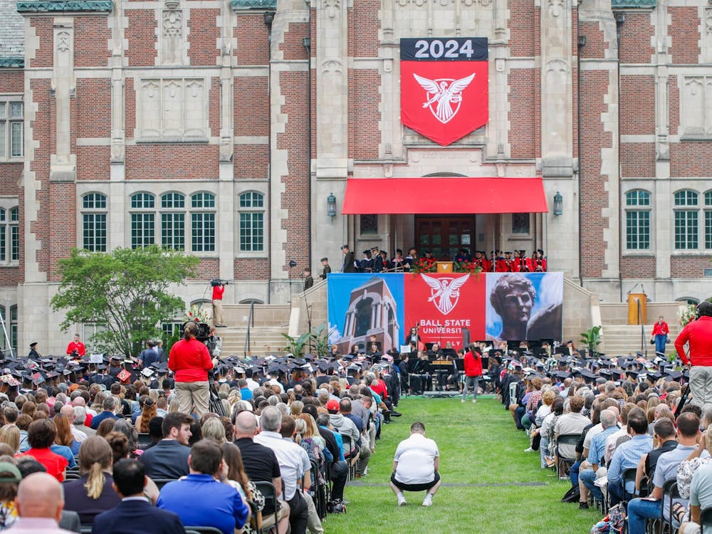
Ball State's May 3 Commencement still to be held outside, light rain predicted
By NewsLink Indiana Weather and Staff Reports / 5 hours agoBall State University's Spring 2025 commencement ceremony May 3 is not expected to be indoors, despite forecasted rain showers in the early morning.

I enjoyed each moment of Severance Season 2 equally
By Ian Case / 8 hours agoSeverance Season 2 combines wonderful writing, character performance, and unique art direction to become one of the best shows on television.

'Like a Dragon: Pirate Yakuza in Hawaii' is a mad fun time
By Ian Case / 10 hours agoWhile sporting some of the series’ best gameplay, Like a Dragon: Pirate Yakuza in Hawaii is held back from series peaks by a rather underwhelming story, and repetitive sections.
