


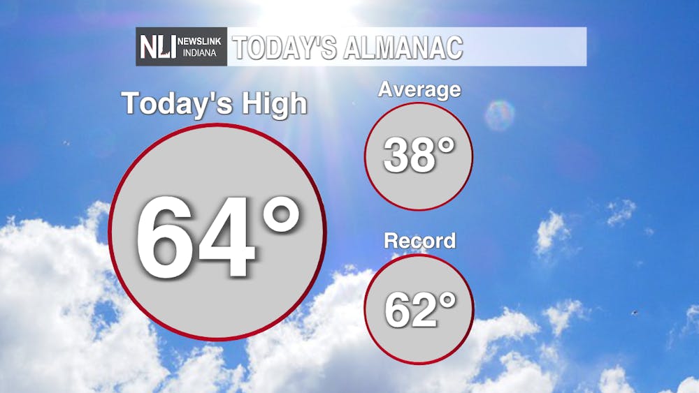
Tonight: Record high temperatures today as high blast past the previous record at 62. Tonight will bring a chance of scattered showers and a cloudy low of 47.

Tomorrow: Showers may for early tomorrow morning as we are all getting up for the day but will quickly move out of the area bringing us another blue sky evening with a not as warm high of 55 by 5:00 PM.

7-Day Forecast: A deepening jet stream will return temperatures back to normal as the work week begins. A chance of snow is expected on Wednesday as lows drop well below freezing, bringing back frost and other wintery weather.
--Weather Forecaster Tyler Miller
Follow us on Twitter @NLIWeather for breaking weather updates.
NewsLink Indiana is a proud Ambassador for the NOAA Weather-Ready Nation program.
For more information about the Weather-Ready Nation program please click HERE


