
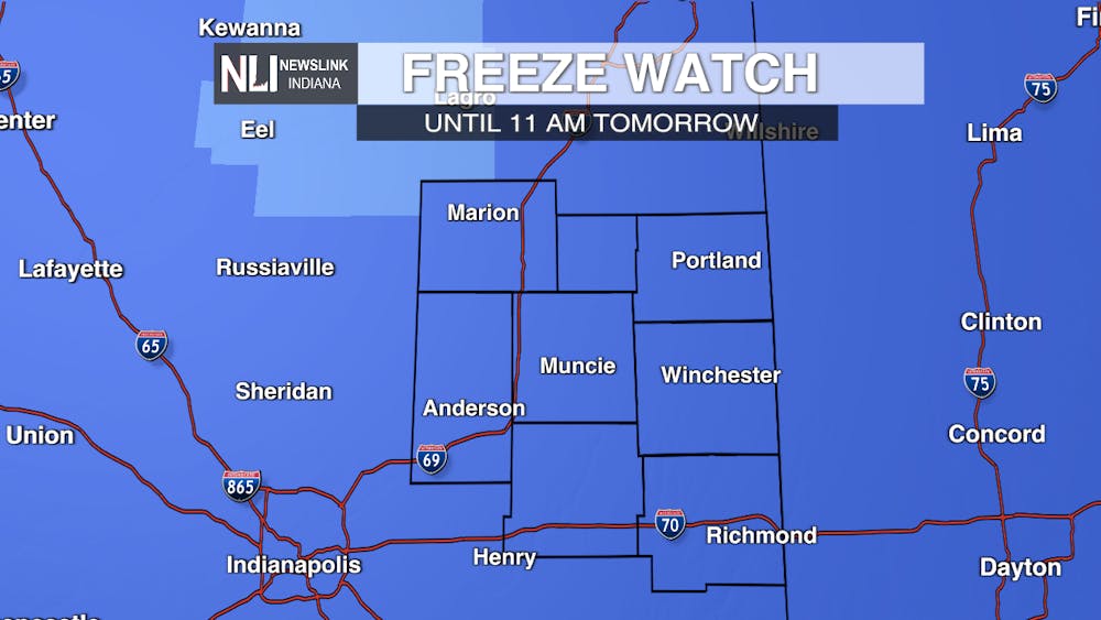
Alert: The National Weather Service in Indianapolis pushed out a Freeze Watch across much of central Indiana, including the NLI viewing area. This will be in effect tonight and will go until 11:00 AM tomorrow. Expect freezes in areas that reach 32 degrees or lower during the overnight hours.
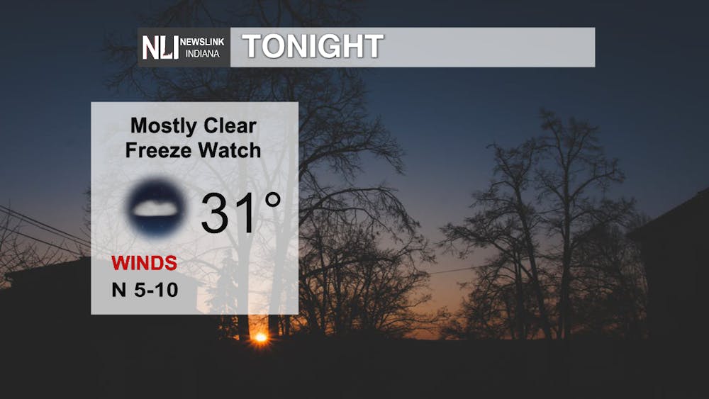
Tonight: Freeze Watch in effect until 11:00 AM Saturday. Mostly clear and cool, with lows in the lower-30s, with below freezing potential.
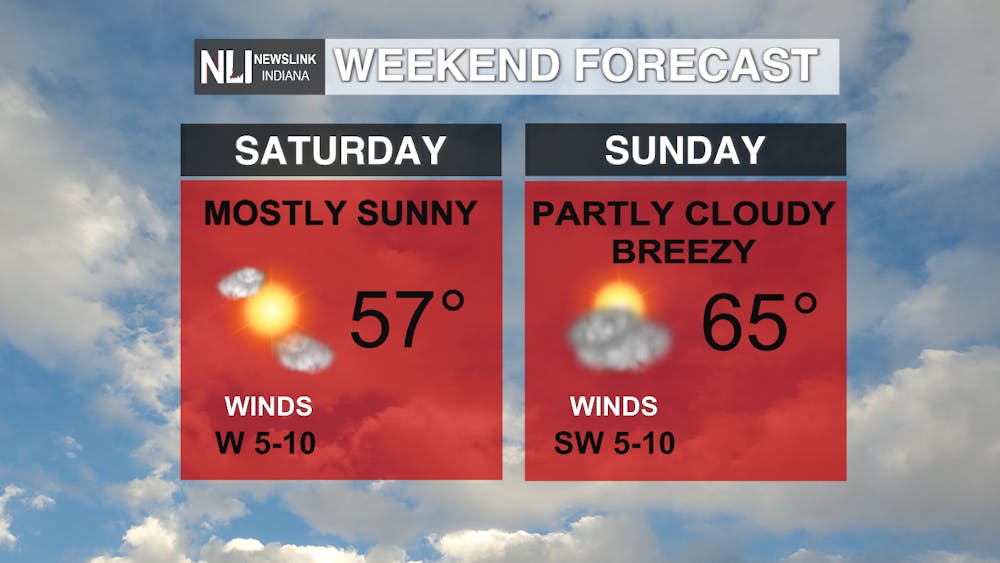
The Weekend: A warming trend will begin over the weekend with highs still in the mid-to-upper-50s on Saturday and mostly clear, becoming partly cloudy and mid-60s for our high temperatures on Sunday. It will be breezy Sunday with some gusts up to 20 mph.
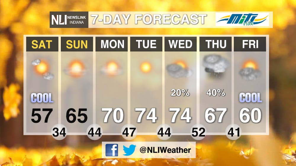
7-day: The warming trend over the weekend continues throughout the majority of the 7-day forecast. Clear skies to begin the work-week, but cloudy skies and some rain potential, in association with a cold front, will bring cooler temperatures at the end of the 7-day.
--Weather Forecaster Lance Huffman
Follow us on Twitter @NLIWeather for breaking weather updates.
NewsLink Indiana is a proud Ambassador for the NOAA Weather-Ready Nation program.
For more information about the Weather-Ready Nation program please click HERE
Read More

Rags to Riches: Muncie thrift stores work to give used items a second chance.
By Lilly Arnholt / 2 hours agoMuncie thrift stores work to give used items a second chance.

Comm Center Catchup: See what you missed
By Ball State Daily / 12 hours agoWith the last week of the semester creeping up, we know it’s easy to miss important announcements from Ball State’s Communication Center! Don’t fret — Ball State Daily has your back! This week, learn about the Multicultural Center’s annual Celebration of Excellence, important updates in OneDrive policies and the Art in Boom exhibit.
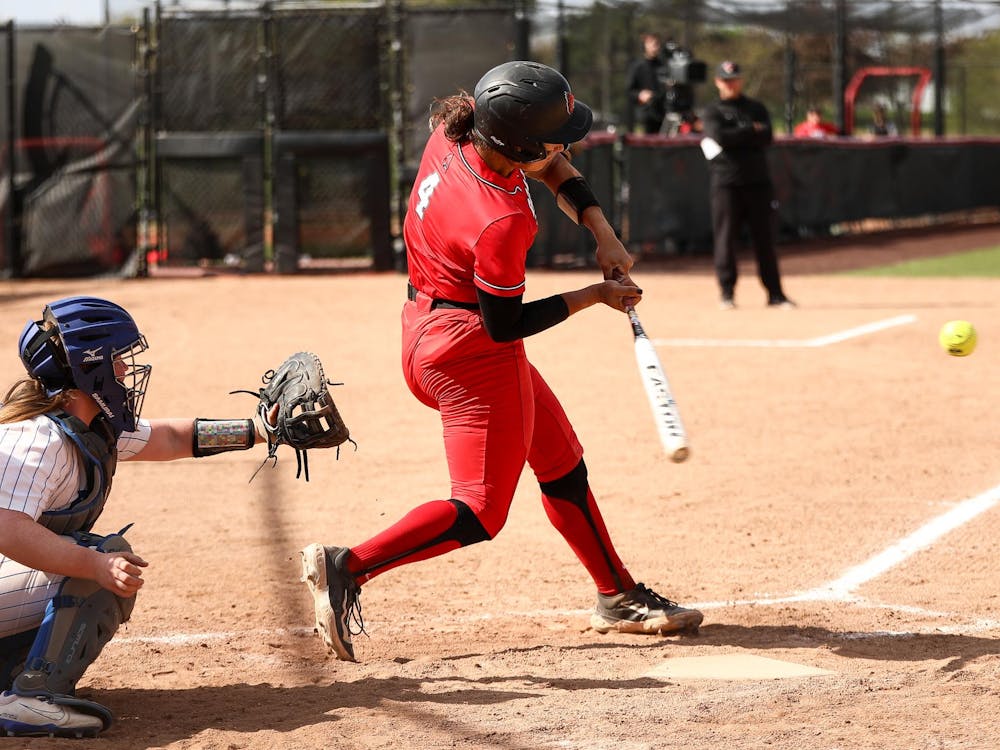
Ball State softball drops weekend series to Buffalo, clinches spot in MAC Tournament
By Zach Carter / 19 hours agoBall State dropped this weekend's three-game series to the visiting Buffalo Bulls 2-1.
