
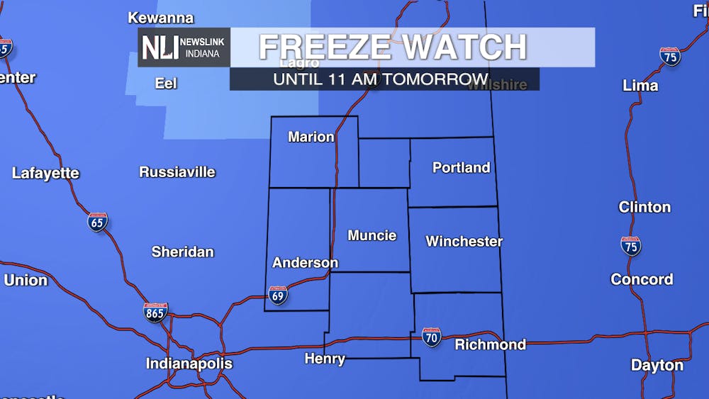
Alert: The National Weather Service in Indianapolis pushed out a Freeze Watch across much of central Indiana, including the NLI viewing area. This will be in effect tonight and will go until 11:00 AM tomorrow. Expect freezes in areas that reach 32 degrees or lower during the overnight hours.
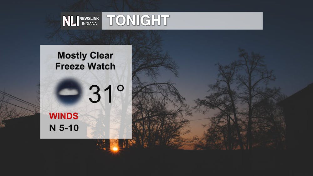
Tonight: Freeze Watch in effect until 11:00 AM Saturday. Mostly clear and cool, with lows in the lower-30s, with below freezing potential.
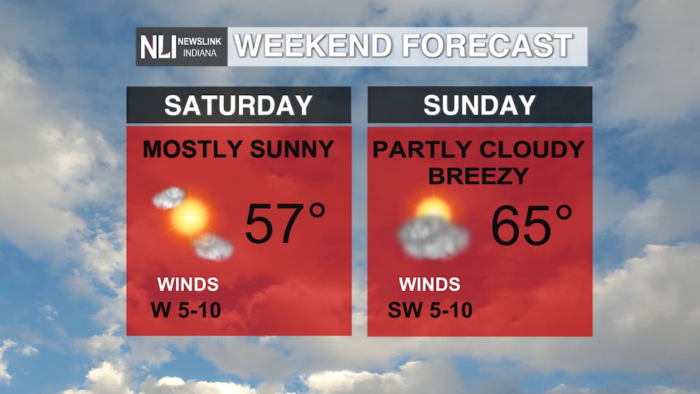
The Weekend: A warming trend will begin over the weekend with highs still in the mid-to-upper-50s on Saturday and mostly clear, becoming partly cloudy and mid-60s for our high temperatures on Sunday. It will be breezy Sunday with some gusts up to 20 mph.
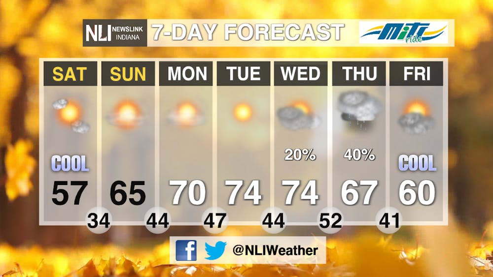
7-day: The warming trend over the weekend continues throughout the majority of the 7-day forecast. Clear skies to begin the work-week, but cloudy skies and some rain potential, in association with a cold front, will bring cooler temperatures at the end of the 7-day.
--Weather Forecaster Lance Huffman
Follow us on Twitter @NLIWeather for breaking weather updates.
NewsLink Indiana is a proud Ambassador for the NOAA Weather-Ready Nation program.
For more information about the Weather-Ready Nation program please click HERE
Read More

‘Grit, family and trust’: Ball State softball prepares for 2025 season
By David Moore and Rylan Crum / 1 hours ago

Ball State set to restructure the College of Sciences and Humanities
By Meghan Braddy / 8 hours agoBall State’s College of Sciences and Humanities (CSH) is finding new departmental synergies.

Ball State women’s basketball remains perfect in MAC with win over Bowling Green
By Elijah Poe / 15 hours agoBall State (19-4) notched win number 13 in a row against Bowling Green (11-11, 5-6 MAC) with a 71-51 win and set a new program record for the best start to the Mid-American Conference regular season (11-0).
