


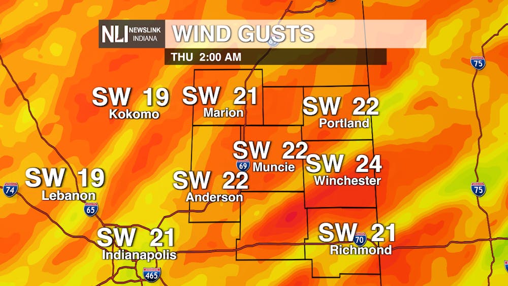
Tonight: Temperatures are going to be dropping pretty quickly as we go into tonight with a low of 44 degrees. Expect scattered showers throughout the night. Winds will be coming in from the southwest at 10-15 MPH with gusts of up to 25 MPH.

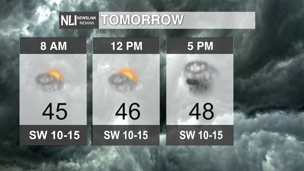
Tomorrow: Plenty of rain pockets to be aware of as we head into tomorrow as well. I am tracking the heaviest rainfall around 5PM tomorrow evening. The temperature will stay pretty constant tomorrow with our high being 48 degrees. Those winds will continue to be a problem as well with gusts of up to 25 MPH possible all throughout the day tomorrow so make sure to hold on to those umbrellas!
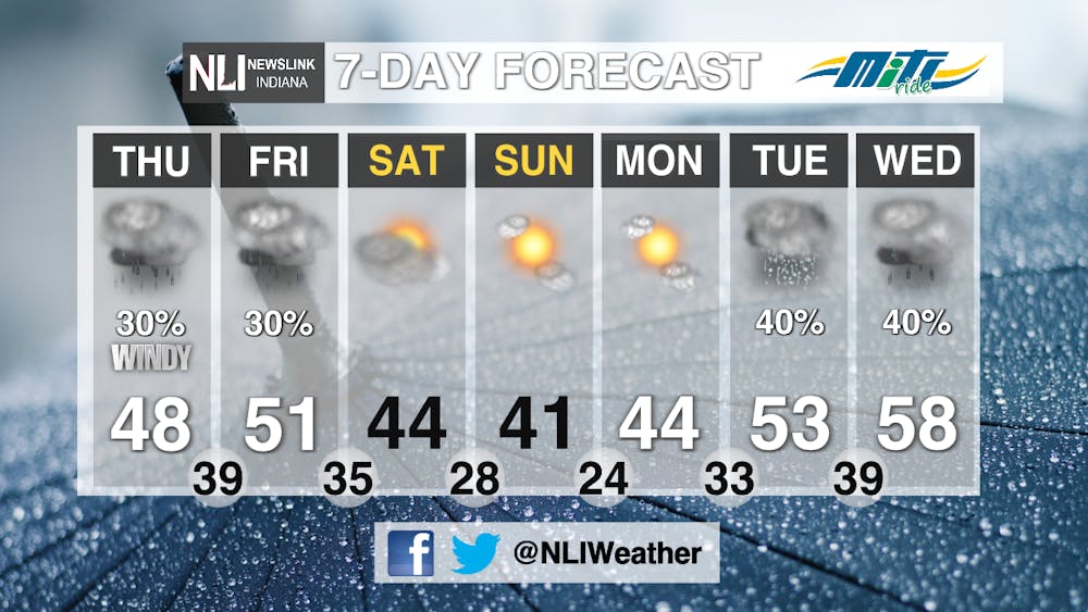
7-Day Forecast: This spotty rain is looking like it is going to continue for the next few days into Thursday and Friday as well. On Saturday we should see a break in the precipitation start with a bit of a temperature drop-off going into the rest of the weekend. As we start our week next week with a very nice but chilly Monday at 44 degrees, we will see the return of those chances for precipitation starting Tuesday and going into Wednesday.
-- Weather Forecaster Dimitri Gegas
Follow us on Twitter @NLIWeather for breaking weather updates.
NewsLink Indiana is a proud Ambassador for the NOAA Weather-Ready Nation program.
For more information about the Weather-Ready Nation program please click HERE


