
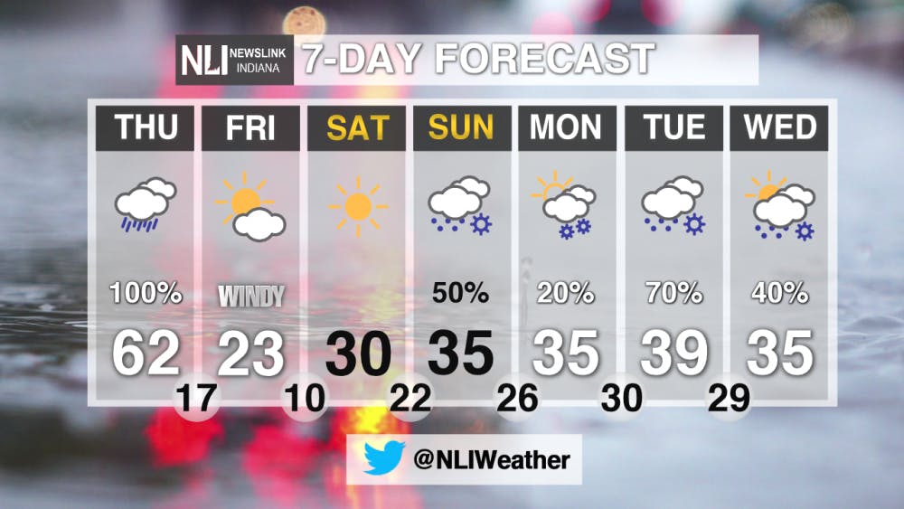
Tonight: Rain chances will return as we get into the overnight hours. Temperatures will be steady, dropping down until the mid 40s. A FLOOD WATCH is in effect until 1 AM Friday


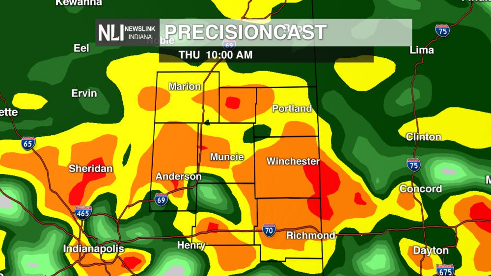
Tomorrow: Heavy rain will be likely with thunderstorms possible. Temperatures will warm to around 60 degrees. Temperatures will rapidly fall tomorrow evening after a cold front moves through.

7-Day Forecast: Temperatures will be back into the 20s and 30s for the weekend. Rain and snow chances will return on Sunday and stick with us through Wednesday.
--NewsLink Indiana Weather Forecaster Hannah Stutler
Follow us on Twitter @NLIWeather for breaking weather updates. NewsLink Indiana is a proud Ambassador for the NOAA Weather-Ready Nation program.
Read More

Ball State Professor Nicole Etcheson’s book has been adapted into a documentary film
By Gracie Parkhurst / 18 hours agoNicole Etcheson’s 350-page book, “A Generation at War: The Civil War Era,” covers the lasting effects of the U.S. Civil War on life in Putnam County, Indiana.

Anti-Trump protest held along the Wheeling Avenue and McGalliard Road intersection
By Hannah Amos / YesterdayMuncie community members participate in a nationwide protest along Wheeling Avenue and McGalliard Road intersection holding signs and chanting against the Trump administration.

Painful Protection
By Ella Howell / YesterdayMedical professionals need to stop diminishing the possibility of pain from IUD insertion.
