WCRD Weather — Over the past several days many people have come across forecasts on social media calling for “devastating” snow storms with snow totals over 2 feet. The forecasts seem to be legitimate and are often accompanied by intimidating weather maps that the typical viewer does not fully understand. Lacking the knowledge to independently interpret these maps and having yet to see posts to the contrary, this can send people into somewhat of a panic.
The good news: we are not going to be seeing anywhere close to 2 feet of snow this week. The bad news: we will be seeing some snow, which could be significant in nature. While I am expecting the region to receive accumulating snow, and some totals are expected to be high, I will not give a number just yet. The reason behind this is that weather models, especially with snow, are highly variable up until around 24 to 48 hours in advance of a storm.
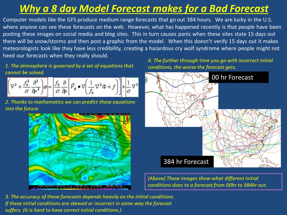
Now you may be asking yourself, why use these models if they are so inaccurate? That is a fair question, but to fully answer this we must understand the complexity of the system that we are dealing with. The atmosphere is what is known as a chaotic system. This means the accuracy with which we forecast events is only as good as the initial conditions we put in. These conditions come from weather balloons, surface observation, planes with the proper equipment, and even the previous model runs. If you look at the map linked below you will see every location where a weather balloon is launched. The map includes many noticeable gaps.
Our models can only be as accurate as the data we put in them. Since we do not have a solid way to gather data across the entire nation, errors and assumptions are factored into these models. These errors, while small at first, grow exponentially toward the future while modeling a chaotic system like the atmosphere. With this in mind, when you see a forecast or forecasts for a “monster snow storm” that is a week or more a way, please take it with a grain of salt. In my professional opinion, snow totals are most accurate within 48 hours of a storm, and even these are subject to change. Weather, and in particular winter weather, is a difficult thing to forecast. Thus the viewer must be aware of the evolving forecast, and check back for updates daily.
With that in mind, the human forecast, local TV, radio, and newspapers, is often always a better source than your iPhone or Android apps. Unless the app is from one of those local sources, it likely just repackages the same computer models we explained in this article. For those of you concerned with Tuesday’s snowfall, please tune to WCRD 91.3 FM, NewsLink Indiana on Cardinal Vision 57, and the forecast in The Daily News this Monday and Tuesday for exact totals. Try to stay warm Ball State!
For the official NWS explanation, please see the graphic to the right of the beginning of this article.


